
US, Civil War Maps, 1861-1865
Records: 1,933Complete: 100%
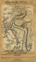
Maps, charts, and atlases depicting battles, troop positions and movements, engagements, and fortifications during the Civil War, 1861-1865.
Continue reading ›Example Records
Sample

Sample

Source Information
Fold3, US, Civil War Maps, 1861-1865 (https://www.fold3.com/publication/699/us-civil-war-maps-1861-1865 : accessed Apr 24, 2024), database and images, https://www.fold3.com/publication/699/us-civil-war-maps-1861-1865
- Publication Title
- US, Civil War Maps, 1861-1865
- Total Records
- 1,933Complete: 100%
- Content Source
Fold3
- Published on Fold3
- May 20, 2010
- Last Updated
- November 18, 2011