
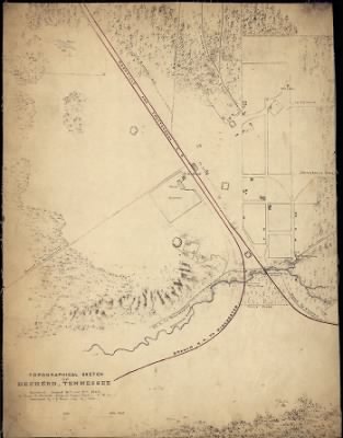
Decherd›Topographical sketch of Decherd, Tennessee / surveyed August 26th and 27th, 1862, by Capt. N. Michler, Corps of Topogl. Engrs. - U.S.A., assisted by by J. E. Weyss, Maj. Ky. Vols.
- Publication:
- US, Civil War Maps, 1861-1865
- Region:
- Tennessee
- Location:
- Decherd
- Title:
- Topographical sketch of Decherd, Tennessee / surveyed August 26th and 27th, 1862, by Capt. N. Michler, Corps of Topogl. Engrs. - U.S.A., assisted by by J. E. Weyss, Maj. Ky. Vols.
- Source:
- Library of Congress Geography and Map Division Washington
- Description:
- Surveyed August 26th and 27th, 1862, by Capt. N. Michler, Corps of Topogl. Engrs. - U.S.A., assisted by by J. E. Weyss, Maj. Ky. Vols.
- Conflict Period:
- US Civil War
View the actual high resolution document.
About US, Civil War Maps, 1861-1865
Maps, charts, and atlases depicting battles, troop positions and movements, engagements, and fortifications during the Civil War, 1861-1865.
Source Information
Fold3, US, Civil War Maps, 1861-1865 (https://www.fold3.com/document/260559761/topographical-sketch-of-decherd-tennessee-surveyed-august-26th-and-27th-1862-by-capt-n-michler-corps : accessed May 2, 2024), database and images, https://www.fold3.com/document/260559761/topographical-sketch-of-decherd-tennessee-surveyed-august-26th-and-27th-1862-by-capt-n-michler-corps
- Publication Title
- US, Civil War Maps, 1861-1865
- Total Records
- 1,933Complete: 100%
- Content Source
Fold3
- Published on Fold3
- May 20, 2010
- Last Updated
- November 18, 2011
Related Records
Related Publications
- US, The Horse Soldier Civil War Collection of Military Artifacts, 1861-1865
- Civil War Stories
- US, General Court Martial of Gen. George A. Custer, 1867
- US, Subject File of the Confederate States Navy, 1861-1865
- US, Official Records of the Union and Confederate Navies, 1861-1865
- US, Maine, Burial Records of the Togus National Home for Disabled Veterans, 1874-1938
- US, Weekly Returns of Enlistments at Naval Rendezvous ("Enlistment Rendezvous") Jan. 6, 1855-Aug. 8, 1891
- US, New Hampshire, Revolutionary War Records, 1675-1835
- US, Washington State Military Records, 1855-1950
- US, Adjutant General Military Records, 1631-1976
- See all publications