
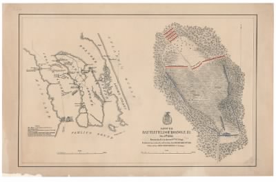
Roanoke Island›Map of the battlefield of Roanoke Id. Feb. 8th 1862 / drawn by Lt. Andrews, 9th N.Y. Regt ; published by authority of the Hon. the Secretary of War, Office of the Chief of Engineers, U.S. Army.
- Publication:
- US, Civil War Maps, 1861-1865
- Region:
- North Carolina
- Location:
- Roanoke Island
- Title:
- Map of the battlefield of Roanoke Id. Feb. 8th 1862 / drawn by Lt. Andrews, 9th N.Y. Regt ; published by authority of the Hon. the Secretary of War, Office of the Chief of Engineers, U.S. Army.
- Source:
- Library of Virginia Richmond
- Description:
- Drawn by Lt. Andrews, 9th N.Y. Regt ; published by authority of the Hon. the Secretary of War, Office of the Chief of Engineers, U.S. Army.
- Conflict Period:
- US Civil War
View the actual high resolution document.
About US, Civil War Maps, 1861-1865
Maps, charts, and atlases depicting battles, troop positions and movements, engagements, and fortifications during the Civil War, 1861-1865.
Source Information
Fold3, US, Civil War Maps, 1861-1865 (https://www.fold3.com/document/260558627/map-of-the-battlefield-of-roanoke-id-feb-8th-1862-drawn-by-lt-andrews-9th-ny-regt-published-by-autho : accessed Apr 24, 2024), database and images, https://www.fold3.com/document/260558627/map-of-the-battlefield-of-roanoke-id-feb-8th-1862-drawn-by-lt-andrews-9th-ny-regt-published-by-autho
- Publication Title
- US, Civil War Maps, 1861-1865
- Total Records
- 1,933Complete: 100%
- Content Source
Fold3
- Published on Fold3
- May 20, 2010
- Last Updated
- November 18, 2011
Related Records
Related Publications
- US, The Horse Soldier Civil War Collection of Military Artifacts, 1861-1865
- Civil War Stories
- US, General Court Martial of Gen. George A. Custer, 1867
- US, Subject File of the Confederate States Navy, 1861-1865
- US, Official Records of the Union and Confederate Navies, 1861-1865
- US, Maine, Burial Records of the Togus National Home for Disabled Veterans, 1874-1938
- US, Weekly Returns of Enlistments at Naval Rendezvous ("Enlistment Rendezvous") Jan. 6, 1855-Aug. 8, 1891
- US, New Hampshire, Revolutionary War Records, 1675-1835
- US, Washington State Military Records, 1855-1950
- US, Adjutant General Military Records, 1631-1976
- See all publications